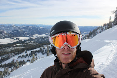
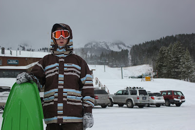
Thursday, December 01, 2011

Journeys: Storm Castle

It was my next to last day renting snowshoes from REI and I wanted to put them to good use. Originally I had lined up a 16 mile (roundtrip) hike in the Lee Metcalf Wilderness, but that would no longer work since I had a 4 PM boot ski boot fitting and molding appointment in Big Sky. As a Plan B, I set my sights on a prominent Gallatin Canyon feature with a short hike, Storm Castle. Storm Castle is a large rock formation that sits perched approximately 2000 feet above the canyon floor above the Gallatin River. It does look something like a castle, but offered me little shelter from the snow storm that I hiked in.

Storm Castle from the trail.
Photograph by Chuck Bolte.

I pulled into a snowy and empty trailhead parking lot. Just as I set my first boot outside of the truck a strong wind kicked up and small pellets of snow poured down from the gray sky. If it were rain, I would say that I would have been frustrated, but since it was snow I could only revel in the beauty of a western winter. I strapped on my snowshoes, shouldered my pack, and started up the well benched in Storm Castle Trail.

Creaking pine stand.
Photograph by Chas. B.

As I was passing through the above pictured creaking pine stand, I was startled by a low growl. Or was it a low growl? Call it the result of a concerned room mate filling my head with bear country warnings and my recent reading of Bear Attacks Their Causes And Avoidance by Stephen Herrero. I stopped and stood still, surveying the pine stand, waiting. Nothing moved, but the swaying tops of the pine trees. I heard the sound again and suddenly realized that the only movement in the woods other than me was the swaying tree tops and they were making a loud creaking sound. I had survived an imaginative bear attack spurned by pine trees. I settled down and pushed on.

Many, many switchbacks later near the base of Storm Castle I was off trail, but not lost. I could only assume that I had hiked straight through a switchback 100 yards back, but being so close to the rock I had not interest in going back. I hiked up to the base of the rock and explored. The climber in me saw numerous potential routes that I would have to research before the snow melted. I continued circling east hoping to find a chink in castle's armor that would allow me to summit on my snowshoes. There was nothing. Loose rock and thin snow made snowshoeing difficult, so I started searching for the trail again. I saw a trail like trough 50 yards below me and hiked down the slope to it. Indeed it was the trail.

Moss just hanging on.
Photograph by Chas. B.

Soon I was moving rather quickly and moved past Storm Castle gaining the ridge behind it. Then the trail double backed and followed the ridge to and easy path to the summit of the Castle. The wind was howling as I stopped to enjoy the stormy view and take pictures.

Panorama.
Photograph by Chas. B.

Summit pose.
Photograph by Chas. B.

It had taken me two and half hours to reach the top. Rather slow for a 2.5 mile hike, but I had definitely enjoyed stopping frequently and drinking in the scenery. I moved fast on the descent to warm up from standing, exposed, in the wind taking pictures. 45 minutes later I was back at my truck. The snow was coming down even harder. Good for us at the resorts!

What a hike! So glad to be out west!

Saturday, November 26, 2011

Journeys: 1st Snowshoe Adventure

I had never been snowshoeing, but was interested in cutting my teeth now that I was out west and enjoying recent snowfall. I stopped by REI and rented a pair of MSR EVO Ascent snowshoes. I liked that the snowshoes had an optional tail for deep powder. I wanted to hike around Mount Blackmore in Hyalite Canyon south of Bozeman, but the avalanche conditions were bad enough that I needed to change plans. Having hiked at Bridger Bowl a few times I decided I would snowshoe there since I had seen the conditions first hand.

It was a great sunny day and I eagerly started up the slopes from the Bridger lodge. I could tell a huge difference between hiking in my snowboard boots versus the snowshoes almost immediately. I was moving quickly up the green bunny slope, then kept good speed up the steeper blue slope at the Bridger lift. The snowshoes were faster than me. I could move so quickly on the snow that I had to slow down and catch my breath for the first time.

Surprisingly, I only made it to the Bridger lift mid station seven minutes faster than with my snowboard boots. I looked up the black diamond slope in front of me and trudged straight up the steepest part, pushing the snowshoes to their fullest potential. The snowshoes performed well, but in the deeper powder I had to stomp my feet down a few times before taking a step. Otherwise I would slip and did not want to cartwheel backwards down the slope. I continued up, moving slowly, but efficiently. I reached the bottom of the t-bar lift. I had not been this high before and the view was great, but I was eager to get to the top and play on the ridge. Slow and steep hiking finally brought me to the top of the t-bar lift and the ridge. The 360 degree view of the valley and other mountain ranges was spectacular. I hiked around on the ridge for another hour, taking pictures and planning destinations for future trips.

Snowshoeing on Bridger ridge.
Self Portrait.

After an hour I started to get cold in the howling wind and started down the mountain. I quickly found out that descending with snowshoes was much harder than ascending. I was a mess. Slipping and sliding down the steep slope. Near the top of the ridge it was not too difficult sliding down deep powder, but I as I descended I ran into frozen snow pack and had trouble staying upright. Walking straight down the slope seemed dangerous for my ankles and knees, so I started zigzagging. It was slow going, but I was focused on keeping my balance. Occasionally the frozen snow would break through and I would slip and fall, but no serious injuries resulted. I did take a doozy lower down when I stepped into deep powder and the snowhoe caught on a small tree. My next step forward sent me sprawling forward, my foot still caught in the tree. Frustrated, I collected my self and marched on. I had made it back down to the blue (easier) slope and was able to move faster, but still felt like I could have gone faster if I had just taken the snowshoes off.

At the bottom of the Bridger lift I ran into a dude named Mark and his buddy. They were skiers building a jump for some late afternoon action. I jumped in and helped them move snow and asked if I could take a few pictures. They were down with the pictures and thankful for the help. 45 minutes later we were finished and Mark got busy sticking backflips and 360s.

Bridger Backflip.
Photograph by Chas. B.

All in all it was a great day. I look forward to hitting some more remote snowshoe trails, hopefully near the Spanish Peaks.

Monday, November 21, 2011

Journeys: Bridger Hike II

Sunday, fun day. The Cats lost to Griz big time yesterday greatly changing the playoff picture. Oh well, guess we will have to go hiking today.

Paul and I got to Bridger close to 1 PM and it was plenty warm out as expected. I had stripped down to just one Capilene layer and my jacket and ended up being too warm again. It was a really nice day and the sky was clear compared to Friday when it had been cloudy and visibility low. Paul and I started our hike slow and steady stopping for a break at the bottom of the Bridger lift. Paul's friend Cyrus caught us on his skinned up skis at the lift and we chatted for a while. Paul and I made a plan that I would hike to the top of the Bridger lift and he would hike to the mid station and wait for me to come down. We set off again and started up the steep blue section under the Bridger lift. This time it was much easier because it had been slightly groomed and there was not as much powder to fight through. I made it to the mid station and got busy with and even steeper black diamond section. Fortunately, there was already a boot pack trail leading up the slope and I did not have to blaze my own through the powder. Up and up I went. At the top of the steep slope I came to a groomed road and followed it through one switch back to the top of the Bridger lift. I took some pictures and rested.

Crazy Mountains from Bridger.
Photograph by Chas. B.

The sun dipping behind the ridge at Bridger.
Photograph by Chas. B.

Self portrait at the top of the Bridger lift.

Below was a steep powder section and I decided to drop into it. Big mistake. This high up the snow had not filled in enough to keep me away from all of the rocks and I pin balled my way down the slope. In one particularly bad tumble I bounced my knee off a rock and had to stop and walk the pain off. Back up, I dropped down to the road that I had hiked up and headed for the mid station below. There I found Paul and Cyrus waiting for me and we made the rest of the run to the parking lot together.

Another good hike in the books. Now, I just need to get some skis and skins!

Journeys: Bozeman Bound

Lewis and I made plans to hike the Bridger Bowl ski area today with our new friend Tony. Tony and I would both hike up underneath the Bridger lift then board back down. Meanwhile, Lewis would hike and sled one of the bunny slopes near the lodge to his heart's content.

Hiking then boarding (a.k.a. "earning your turns...bra") was something I was always interested in, but never took part in during my short winter trips out west over the years. As we drove the 16 miles from Bozeman to Bridger my excitement grew as I realized that really had moved to Bozeman and that I really was in a true winter playground. Some of the surreal was starting to wear off and reality was starting to sink in. It was an awesome reality!

We pulled into the Bridger parking lot and geared up. We had expected there to be more of a crowd since we had gotten snow the night before, but the crowd was thin. It was 25 degrees and cloudy, cold by my standards, so I wore three layers underneath my outer jacket. A quarter mile later I would sweating buckets and panting like a dog. Hiking turns every human into a mini nuclear power plant of heat. Fewer layers next time.

At the top of that first quarter mile or so we dropped Lewis off and watched him sled down the hill gaining so much speed that he would have to bail out then get back on. It looked like he was having fun, so Tony and I marched on, headed for the top of the Bridger lift.

Ready to sled shred.
Photograph by Chuck Bolte.

We were hiking a green run then met a blue at the bottom of the Bridger lift. The blue was steeper, but very manageable. We followed snowcat tracks up the steepest part of the slope to avoid having to blaze trail in deep powder. Tony's first layer was drenched, so we stopped for a break and he peeled it off. We were both overdressed. We pushed on. Tony started to fall behind, so I pulled up at the Bridger lift mid station to take a break and wait for him. Once he arrived, we quickly decided that the mid station would be our high point for the day. We had already been hiking for 90 minutes and figured Lewis was probably starting to get bored at the base of the mountain.

Tony repping MSU at the mid station.
Photograph by Chuck Bolte.

We strapped in and started down. The powder was deep and fluffy and back leg immediately started to ache trying to lean back and float on the powder. My old Burton was fighting me at every turn, but it did not matter. I had hiked. I was riding powder. Life was good.

At the bottom we met up with Lewis, who I had apparently passed on the way down, but never saw. We loaded up and drove back to Bozeman content, but Lewis was not finished. On Oak Street we passed a dog park with a small hill in it and Lewis wanted to keep sledding. We pulled in and jumped out and Lewis went right to work building a little kicker.

Bailing.
Photograph by Chas. B.

Lewis got froggy and decided to try and ride across a series of hay bales. I would call it a hay bale manual pad. Surprisingly, he was pretty successful with his idea and ended up riding across three hay bales, but this picture of just two was a good one.

Two hay bale manual.
Photograph by Chuck Bolte.

Tomorrow is Lewis' last day and we have nothing planned other than to drop him off at the airport. Afterwards I will rest and watch the Montana State University Bobcats take on the University of Montana Grizzlies in the region's fiercest football rivalry.

Thursday, November 17, 2011

Journeys: Bozeman Bound

Yes, we arrived in Bozeman las night, but for Lewis the journey is not finished. Lewis does not fly home to West Virginia until Saturday, so now our mission is to show Lewis what Montana is all about. Initially, we wanted to visit the Galt Ranch near White Sulphur Springs, MT, but the owners did not return our phone calls. So, we drove into the Gallatin Canyon and up to Big Sky and Moonlight Basin. With plenty of snow on the ground, the canyon and the resorts definitely had a rugged Montana appearance.

Lewis enjoys the Gallatin River.
Photograph by Chas. B.

Lewis checks out the Moonlight Basin trail map.
Photograph by Chuck Bolte.

Lewis hanging around the Moonlight Basin lodge.
Photograph by Chuck Bolte.

Lewis' big horn.
Photograph by Lewis Bolte.

After meeting the friendly staff at Moonlight Basin, we drove off the mountain as the sky opened up rained snow down upon us. At the bottom of the mountain, we checked on snowmobile rental availability and came up empty. A snowmobile tour would have been great for Lewis, but his visit fell just in between seasons. No Galt Ranch. No snowmobile tours. What to do tomorrow?

Hike.

Wednesday, November 16, 2011

Journeys: Bozeman Bound

We woke toasty and warm in the cab of the truck. It was cold out, but the sun was just right for pictures in front of Devil's Tower.

Brothers and Tower.
Photograph by Chas. B.

Lewis holds the Tower.
Photograph by Chuck Bolte.

Lewis' Wymoing Trophy.
Photograph by Chuck Bolte.

We drove and drove. We approached the Big Horn Mountains of Wyoming, sighting them from 70 miles away. We turned north and crossed the border into Montana. It was good to see some snow and I looked forward to getting to Bozeman. Just four more hours to cap the long trip.

Finally there...4 more hours to Bozeman.
Photograph by Lewis Bolte.

We made it to Billings and gassed up. One more fuel stop in Livingston and we would be there. I was eager and pushed the truck through the wind. My leg hurt from holding the gas pedal down for so long, but it took it being on the floor just to hold 65 mph. We rolled into Livingston just long enough to fill up and were only 20 miles away from Bozeman. We pressed on, crossing the Bridger Mountains and dropping down through Bozeman Pass.

Finally we were there.

Tuesday, November 15, 2011

Journeys: Bozeman Bound

I woke up at 7 AM. The windows of the redneck RV were frosted, but my sleeping bag cocoon was warm. We brushed our teeth and set off for Minnesota. A short hour later we were across the border and filled up on gas. We started west on I-90 and were greeted with a ferocious wind. A wind that would keep up all the way to Bozeman and drop the miles per gallon to 8. South Dakota was an expensive state for the trip, but scenic. The flat boredom dissipated as we entered the high plains. The sky got bigger and ranch land rolled out in all directions as far as the eye could see.

Somewhere in South Dakota.
Photograph by Chuck Bolte.

We were making good time despite the wind and I decided to add some stops to the later part of the trip. I did some quick research on my phone and found out that we could visit Mount Rushmore even in the dark since it would be lit up for two hours after sunset. Mount Rushmore would be our first stop. After Mount Rushmore, we would finish the night by driving to Devil's Tower, WY and camping. That way when we woke up in the morning we would be able to visit Devil's Tower in the sunlight before making the final push to Bozeman.

Not long after sunset we pulled into Rapid City, SD and were only 20 miles from Mount Rushmore. It was a steep haul to Mount Rushmore and the town at the base of the mountain, Keystone, reminded me of Pigeon Forge, TN.

Mount Rushmore. Cold.
Photograph by Chuck Bolte.

We did not go into the park, because it looked like we had to pay $11, so we took photos from the road and turned back to Rapid City. Soon we were in Wyoming. It was dark, snowy, and cold. We exited I-90 at Sundance and were on our way to Devil's Tower. As we approached we could just barely make out the silhouette of the monolith off in the distance. We pulled into the scenic overlook area and made our beds. I took the redneck RV again and Lewis remained in the cab.

Five hours into the night it was too cold in the bed of the truck. The windows were iced over and my cold feet were keeping me awake. I guess my thirty degree bag, liner, and blanket were not enough for 20 degree Wyoming. I will have to invest in a good winter bag ASAP. I moved to the cab of the truck and ran the engine with the heater on until 7 AM.

Monday, November 14, 2011

Journeys: Bozeman Bound

We pulled out of Spencer with no fanfare at 9:30 AM. My plan was to drive as far as Iowa City, IA some 660 miles from Spencer. I hoped the 12 x 6 Uhaul trailer I was pulling would not slow us down too much. The trip across West Virginia and Ohio was mostly uneventful. We would drive until there was a quarter of a tank of gas left then fill up. We dealt with some traffic around the Indianapolis beltway, but were soon out of it. We drove, slow and steady, through a fierce storm front sweeping across the heartland of the nation and fortunately did not see any tornados. The sun set in Illinois and we hurtled down the interstate. Somehow we were in Iowa. Everything since Ohio had been flat and uneventful and Iowa was no different. We passed through Iowa City and I still had plenty of energy so we pushed on. Near Nashua, IA I got sleepy and we pulled into the Nashua welcome center for some rest. I slept in the redneck RV and Lewis slept upright in the cab of the truck. It was a chilly, but comfortable night.

Tuesday, November 08, 2011

Journeys: Bozeman Bound

The morning air was cool and crisp. Steve was up before me and had built a small fire to help the Earth warm up, but the sun soon took over the job. By 9 AM it was surprisingly t-shirt and shorts weather so we quickly broke camp and headed back to the base of Stone Mountain. We repeated our ferrying of Steve and the packs to the handicap parking lot then I jogged up from the trailhead parking lot. We were on the Entrance Crack at 10 AM and I knew we had plenty of time to climb the Great Arch and make it back down before 5:30 PM, even at our hampered pace. I also knew, as I was struggling up the Entrance Crack, that I was climbing much worse than yesterday. The tendonitis in my left arm was flaring up again and my calves were sore. Steve came up the Entrance Crack and we walked over to the base of the Great Arch. My assessment of a rough day ahead came true. I struggled to get in rhythm on the first pitch and probably took twice as long to lead it as the day before. For some reason I felt like my feet were going to slip right off the rock every time I put them down. Steve eased his way up the first pitch then I started the second. I finally found some rhythm and made a confident run out over the last 30 feet of the pitch. Steve eased his way up to the top of the second pitch. I started on the third pitch and struggled in places where the crack petered out, losing my rhythm. I finally reached the easier climbing at the top where the dihedral becomes a flake and cruised to the anchors. Steve eased his way up to the top of the third pitch.

Steve enjoying the view on The Great Arch.
Photograph by Chuck Bolte.

I made Steve pose for a hero photo with his oxygen tank and then we made three raps down to the Tree Ledge, then a final rap down to the ground. Steve was in good spirits and was thankful for the experience. Admittedly, it was great to see him out again doing something he had been passionate about for so many years. I was glad to be there to help him along. We were at the truck by 4:30 PM. Steve wondered if we had set a record for the slowest party on the Great Arch. We toyed with the idea of camping on the way home, but ended up pushing through to Roane County, rolling in at 10:15 PM. Exhausted I crashed on the floor of the cabin, finally free of the sea of granite.

Oxygen tank hero pose.
Photograph by Chuck Bolte.

Monday, November 07, 2011

Journeys: Bozeman Bound

Steve and I left Spencer around 7 AM, slightly later than we wanted to. We drove four easy hours through scenic parts of WV, VA, and NC enjoying the views and the conversation. We pulled into the trailhead parking lot at Stone Mountain, NC and prepared a light trad rack for our climb. Steve configured his oxygen tank system (Steve needs oxygen for strenuous activity) then I ferried him and our packs up to the handicapped parking lot, which was much closer to the base of the mountain. I drove back to the trailhead parking lot then jogged back up to the handicapped parking lot. Steve had already started his march to the base of the mountain and I caught him just as he entered the tree line that guards the approach. The November sun flickered through the last stand of brilliant fall foliage, warming us up for the climb.

We found the base of the Entrance Cracks and ran into two local rappel enthusiasts, one of which was a paramedic. Steve joked with the paramedic about his condition and showed off his oxygen tank that he was going to climb with. I am not sure the poor guy knew how to take it all, but he offered his radio should anything go wrong. We roped up and I sent off on the most intimidating 5.4 I have ever touched. I purposely left my chalk bag in my pack at the base of the climb and immediately regretted it after a few minutes of struggling. Stone Mountain was hot in November and I was sweating...profusely. I down climbed to a stance where I could pull up my chalk bag on the trail rope then re-attacked the off-width crux of the pitch. Body jam, scoot. Body jam, scoot. There was a more fluid way to friction up the face to the right of the crack, but I was mentally badgered into the safety of the crack because of the run out. One more body jam and scoot brought me to a slight shelf on the right face. I left the crack here then frictioned up the face to a large tree where I anchored to belay Steve. There were bolted anchors up and to the left, but I felt that it was more important that I could see Steve while he climbed since he would not be able to speak once he started breathing hard.

Steve followed, touching rock for the first time in years after being diagnosed with pulmonary fibrosis. He did exceptionally well considering his condition and it was good to see him climbing again. Once we were both up on the tree ledge, we walked over to the base of a classic route name The Great Arch. From the bottom of the route I could look out and see Stone Mountain in all of its "sea of granite" glory. I was truly amazed how anyone could have climbed the blank face of the mountain and drilled bolts while on lead. I realized that I had a lot of work to do if I was ever going to be comfortable on the Big Stone.

Steve resting before the crux of the Entrance Cracks.
Photograph by Chuck Bolte.

Fortunately The Great Arch is not quite as blank as the rest of the mountain. A three pitch splitter dihedral is the left limit of the climb and a great place for grubby climbing paws. I tightened my shoes and started the beautiful and classic route. The beginning of the route curves out then back in following the dihedral. I place a yellow cam then cranked to a tree, which I slung with a runner. Above the sling I found a bomber hex placement then cranked the rest of the way up to the anchors, placing another cam along the way. I felt like I was starting to meld with the mountain and it felt good. Steve started up climbing well, but having to take breaks to catch his breath. He did look smooth and his footwork was excellent. His experience despite his medical condition showed. Steve made it to the anchors of the first pitch and it was 4 PM. Strict park policy demands that climbers be off the rock and out of the parking lot by 5:30 PM. We knew it was time to turn back, two pitches short of the summit. We would have more time tomorrow to re-attempt the route.

Steve on the first pitch of The Great Arch.
Photograph by Chuck Bolte.

We easily made it back to the truck before 5:30 PM. Temperatures were quickly dropping as the sun went down. We made a bee line for the campground and picked a campsite away from the trees and under the stars. We made up our beds in my redneck RV then stoked up a roaring fire and cooked dinner. August was the last time I had camped or climbed outside. It had been far too long.

Friday, November 04, 2011

Journeys: Bozeman Bound

After much deliberation I decided to leave my life on the east coast and move to Bozeman, MT. I packed up all of my stuff a few days ago, left home in Baltimore, and drove a few hours west to the family farm in Spencer, WV. I will relax in Spencer until November 14th then leave for Bozeman. By "relax" I mean that I will split firewood until my back breaks. My brother, Lewis, will make the drive to MT with me then fly back to WV the following Saturday. I am very excited, yet the whole experience is surreal. I look forward to a new adventure in a new place.

This Monday and Tuesday I will take a climbing trip to NC with Steve to climb around on Stone Mountain.

Now...the firewood.

Can you see the bull's head?
Photograph by Chas. B.

Friday, September 30, 2011

Nonsense: New Toy

I finally traded in my digital video kit for a new photography kit. Of course I only made this move under the condition that my new camera, the Canon Rebel EOS T2i, was 1080p HD video cable (which it is). I suppose I really have a new video and photo kit.

In light of all of this I created a new blog where I feature photos that I take with the T2i. Hopefully we can see some photographic skill improvement over the coming years. Take a peek at chasbphotography.shutterfly.com.

Friday, August 12, 2011

Journeys: SEND IT - August 11th - Ohio/Baltimore, MD

SEND IT is over. It only took four hours to get from Ohio to Morgantown where I dropped Beth Ann off. It seemed like I had picked her up just the day before, not five weeks before. What an incredible journey. It was just me and reflection for the next three hours back to Baltimore. What a trip it had been. I have no words to describe it all.

Awesome.

Total money spent on gas = $1555.27
Total miles driven = 7552.7

Mileage.

Journeys: SEND IT - August 10th - Pierre, SD/Ohio

We had a big day of driving ahead of us since we left Devil's Tower so late the evening before. I hoped to make it from South Dakota to Ohio, roughly 1,000 miles of driving, before we stopped to sleep again. From Ohio it would only be eight or so hours back to Baltimore. We drove and drove and drove and drove. Back through Iowa, Illinois, and Indiana we went. The sun again sank below the horizon and we were hurtling down a dark highway. Everything was a blur. My mind was numb. We had covered so much ground, climbed so much, had returned to the wilderness. It had been epic, awesome, it had rocked. And now it was all over. Our bodies now adjusted to waking to the sun warming our faces would have to readjust to dark bedrooms and alarm clocks. Instead of eight hours of climbing each day we would do eight hours of studying or eight hours of "work". A big part of me did not want to go home, but I knew it was the right thing to do. Just give it some time Charlie, then you can move out west for good. Ah, that thought will be the light at the end of the tunnel. To one day move to a place where so much outdoor satisfaction can be had is truly inspiring. I cannot wait. Finally, Ohio. At 0030 we pulled into a rest stop between Dayton and Columbus and were soon fast asleep in the truck.

Journeys: SEND IT - August 9th - Devil's Tower, WY

I was out of bed and packing up at 0600. Rain moved in at 0630. It sprinkled for just a second, but dark clouds continued to gather all around Devil's Tower. I was worried. I checked the weather map repeatedly and it showed that a significant rain storm was over our heads and another would be on its way later in the day. Climbing in the rain would be impossible for us.

Rainbow over Devil's Tower.
Photograph by Chuck Bolte.

Somewhat dejected we pushed the rest of our camping gear into the back of the truck and drove from the KoA to the Devil's Tower visitor center parking lot. From 0715 to 0745 it rained harder then stopped. We waited in the truck for an hour to see if the rain would continue. No more rain fell, so we registered as climbers and started the approach to the Durrance Route. We followed the approach in the guide book, which does not clearly reveal that the traverse across the southwest shoulder is a long exposed fourth class scramble that is terrifying when wet from rain. We actually roped up for the last 100 feet in case one of us slipped. It was already a long way down at that point and we were not even on the route. Once we were both at the bottom of the Leaning Column I soon realized that the Durrance Approach is not the best way to go. It would be much easier to walk to the bottom of the Meadows Rappel route then rope up for what looked like 100 feet or so of 5.0 climbing. I also noticed that we could easily traverse to the base of the Durrance Route from the rappel anchors at the top of the last rappel on the Meadows Rappel. This allowed us to stash our packs and extra gear under a stunted pine tree at the base of the leaning column. The Durrance Route is rated at 5.6 and I quickly found out that it would be the hardest 5.6 I have ever climbed. Having not climbed many off widths and chimneys in my short climbing career, the climb was extremely difficult, especially the first two pitches. The second pitch was definitely the crux for us and I was definitely cussing before we reached the third pitch, Cussin' Crack. The second pitch had two parallel cracks. On the right an off width for chicken winging and jamming the right side of your body and on the left a hand crack for your left hand and left foot. I took many rests. It was extremely demanding. Beth Ann also felt that it was very challenging. At the belay at the top of the second pitch I could only hope that there was no more of that to come. Fortunately the route did mellow somewhat through pitches three through five.

Last move of pitch three.
Photograph by Chuck Bolte.

At the top of pitch five after pulling through a smelly bird poop cave we had to make the decision of whether or not we would traverse to the Meadows the scramble 140 feet to the summit or simply climb straight up on the Bailey Direct finish above our current belay. The Bailey Direct seemed less complicated to me and a better way to climb the tower from top to bottom, so we finished with the 150 foot final pitch over mostly easy terrain with two bold moves on it. As Beth Ann started to follow the final pitch, the second rain cloud that I had seen on the radar earlier in the day crept up over the tower and started raining. I heard a distant clap of thunder and my shoulders sank. Here we were 10 feet from the top of a 900 foot tower, exhausted, getting soaked in rain, and now lightning threatens to strike our metal laden bodies down and permanently end our road trip on the very last day of climbing. Beth Ann finally made it to the belay as the rain increased then she climbed the final 10 feet to the summit. I scrambled up and we took hurried summit photos before hustling to the top of the Meadows Rappel.

Beth Ann's hero pose.
Photograph by Chuck Bolte.

Chuck's hero pose.
Photograph by BA.

Thunder continued off in the distance, but fortunately there was no lightning close to us. We hurried down the first rappel pitch into the Meadows then traversed to the next rappel station. Three LONG rappels later we were on the ground with our packs. My legs hurt. The stemming and chimney-ing had taken quite a toll and I could not wait to get to the truck and drop my pack.

South east side of the tower.
Photograph by Chuck Bolte.

Durrance Route (starts at base of obvious right leaning column).
Photograph by Chuck Bolte.

We hurried away from the tower, thankfully the rain had stopped, past gobs of bikers taking pictures of the tower. One man shook our hands and congratulated us. We turned in the second half of our climbing registration form stating that we had reached the summit and that was it. The final climb of the trip was over. It had not been the most fun route of the trip and it was impossible to enjoy standing on top of Devil's Tower, but we had done it. It was much later than expected when we pulled out of the parking lot. 1800 if I remember correctly. We got in a few hours of driving arriving at a rest stop outside of Pierre, South Dakota where we slept in the truck for a few hours. Tomorrow we continue on our drive back to the east coast, back to the daily grind.

Journeys: SEND IT - August 8th - Bozeman, MT/Devil's Tower, WY

We were in no rush to leave Montana, but still arrived at Devil's Tower plenty early. As we entered Wyoming I kept my eyes glued to the horizon, expecting to see the tower looming in the distance. I was finally rewarded once we had turned off of the interstate and were heading north on route 14 east. Like City of Rocks, Idaho, Devil's Tower seems to be a freak of nature. Flat prairie stretches for miles in all directions, then suddenly a huge 900 foot tall rock tower shoots up from the prairie floor like an eternal prairie dog. We pulled into the KoA and camped with masses of bikers bound for the huge motorcycle rally in Sturgis. As I lay in the tent reading while the sun went down, I could not help, but to be shocked that tomorrow was the last climb of the trip. The past four weeks had flown by and we would soon be back on the east coast, back to the daily grind. This has been a special trip.

Journeys: SEND IT - August 7th - Bozeman, MT

Today was a lazy rest day. I did laundry then Paul, Beth Ann, and I all went into downtown Bozeman, rented bicycles, and cruised around the Sweet Pea festival. Then, we went over to Belgrade for our final and Paul's birthday dinner in Belgrade. Tomorrow we head to our final destination and last climb, Devil's Tower, Wyoming.

Sunday, August 07, 2011

Journeys: SEND IT - August 6th - Bozeman, MT

Today Beth Ann and I were back in the climbing saddle. I had picked up the Bozeman climbing guide two days before while touring downtown Bozeman and had picked out Bozeman Pass based on a local's advice. Specifically we were headed to the Fat Man wall. It was roadside cragging at its finest. An ample pocket of bolted climbs literally a stone throw from I-90 six miles east of Bozeman. The approach was a mostly flat 0.7 mile jaunt parallel to the interstate. Fat Man wall was west facing and in the shade for most of the time we were there and when the sun did creep around the wall there were plenty of shade trees to hide under. With one 5.8 and many more 5.10s Fat Man made for a great sporty climbing day. The rock was peppered with finger pockets and jugs making up for the "steeper than it looks" pump fest. We threw ourselves into the thick of it climbing the jugs until we were just to tired to hold on.

Beth Ann on Nagasaki.
Photograph by Chuck Bolte.

Beth Ann on Duck and Cover.
Photograph by Chuck Bolte.

Beth Ann on The Natural.
Photograph by Chuck Bolte.

I really thought it was a great place to climb. Plenty of shade in the morning, an easy approach, and great features leading to challenging moves and tests of strength. Tomorrow we continue to relax, do laundry and prepare for our final destination and climb, Devil's Tower, Wyoming.

Journeys: SEND IT - August 5th - Bozeman, MT

Today we drove through Yellowstone National Park, acting the tourist, and hitting all the classic stops. Loads of driving brought us through the beautiful park, past geo thermal activity, to Old Faithful, and Lower Yellowstone Falls. I had hoped to see a bear, but only saw buffalo, elk, and a coyote. Enjoy the pictures!

The Madison River.

A cyclist.

A tree fell down.

Ranger talk.

Old Faithful.

Blurry elk.

Lower Yellowstone Falls.

Blurry buffalo.

Journeys: SEND IT - August 4th - Bozeman, MT

We arrived in Bozeman yesterday evening. We had taken highway 20 in from Idaho and amazingly got a long glimpse of the Tetons miles and miles to the east in Wyoming. We passed through tour-isty West Yellowstone and drove the length of the Gallatin Canyon passing Big Sky and Moonlight Basin ski resorts where I had snowboarded in early 2010. It was good to be back in Montana, big sky country. We did not have much of a plan for Bozeman, but I wanted it that way. I just want to laze around for a day, see Yellowstone another day, climb one day, laze another day, then head to Devil's Tower. Today we got in plenty of lazing. We enjoyed downtown, bustling with the Sweet Pea Festival 2011, then drove all the way up to Big Sky and Moonlight Basin for a late lunch and to see the beauty of the resorts sans snow. It was a scenic afternoon up in the mountains with no snow. No botched approaches, no unforgiving routes. Just a day of relaxation to regroup and rest.

Journeys: SEND IT - August 3rd - Salt Lake City, UT/Bozeman, MT

After talking with my friend Paul in Bozeman, MT, our next stop on the trip, we decided we would leave for Bozeman on the afternoon of the 3rd instead of the morning of the 4th. Paul had taken time off of work and wanted to maximize his days off. We would not leave Salt Lake City without climbing though. We headed to a popular roadside crag in Big Cottonwood Canyon called the Salt Lake Slips, where had another mini epic before we even started climbing. The SL Slips are located near the same pull out for Dead Snag and Glass Ocean, but is on the north side of the creek and in about 25 yards. The guide book urges climbers to take extreme care in crossing the creek since people have been swept away and drowned in the past. On my initial look I could find no viable crossing and started to search for other avenues of approach. If we drove down stream a quarter of a mile we would cross a bridge putting us on the same side of the creek as the Slips. It looked like if we parked at the bridge we could simply walk upstream and get to the Slips. We parked, walked, and were dismayed when we came to a rock outcropping, the Creekside Crag, that offered not an inch between rock wall and raging white water. We delicately scrambled up and over the rock with the water 20 feet below us and found bolted anchors at the top of a climb on the east side of the wall. We tediously rappelled down repacked the rope and walked on. We did not get very far. The gully between Creekside Crag and the Slips was much larger than I thought, It was also steeper, looser, and more choked with vegetation than it needed to be too. I was cursing again. Falling my way up a steep dirt slope, then bushwhacking my way through dense saplings we finally came to the top of what I hoped was the Slips. I found a set up bolted anchors, which were the top of a two pitch sport climb on the Slips called the Italian Arete. I flaked out the rope for the rappel and ran it through the rappel rings, then clipped my cowtail into the anchors and got ready to swing over the lip of the top of the cliff. As I was peering over, my foot caught probably the only loose rock at the top, sending it skipping down the face just as a climber was topping out of the first pitch on a ledge below us. "Rock!", I yelled. The climber blankly stared up at us. It was a slow motion moment. The rock's initial descent was away from the climber, but after two skips off the face it was tracking directly towards him. I had time to yell, "Watch out bro!" He sort of turned his head and the rock glanced off of his right shoulder. I felt like a total piece of [insert derogatory word here]. We rappelled and once on the ground I apologized ferociously. The climber was uninjured and forgiving. This had been the worst approach of my time as a climber. We had crawled for an hour over a quarter mile of terrible terrain to get to a wall 50 yards from the road and then I hit another climber with falling rock. I did not want to climb. I just wanted to leave. Big Cottonwood Canyon had taken its toll on me these last two days. Fortunately, I was able to put aside my completely bruised, broken, shattered ego and knock out some enjoyable sport climbs at the Slips.

Beth Ann climbing at the SL Slips.
Photograph by Chuck Bolte.

When we ran out of time and had to pack up, we asked some other climbers if there was a faster way back. They told us there was an easy creek crossing just at the end of the crag. There sure was. A single strand of webbing tied between two trees spanned a shallow part of the creek, providing the needed security to overcome the swift, cold current.

Beth Ann. Cold. Very Cold.
Photograph by Chuck Bolte.

We were back at the truck in 10 minutes versus the the hideous hour long approach, which somewhat lifted our spirits as we left Salt Lake City bound for Bozeman. Big Cottonwood Canyon had done its damage, yet I cannot wait to return and again face the demons that were so cruel to me. The lure of climbing is undeniable.